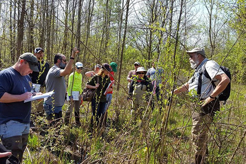
Wetland Delineation is a process that requires an adequate knowledge of the hydrologic, soil and plant characteristics of wetlands to determine which parts of the landscape are wetlands and how to define their boundaries. In this course our instructors provide thorough training in the protocols covered in the 1987 US Army Corps of Engineers Wetlands Delineation Manual and its Regional Supplements. These protocols can be used to identify areas that possess the appropriate combination of wetland hydrology, hydric soils, and wetland plant communities to be considered jurisdictional wetlands.
During this course, we will cover all aspects of the wetland delineation process through classroom sessions and hands-on field training. Instructors will describe the different types of wetlands, their varying hydrologic, soil, and plant features, and how to best collect and record the important data that separates wetlands from their surrounding landscapes.
Special emphasis will be given to the field indicators of wetland hydrology, hydric soils, and wetland plant communities detailed in the Midwest, Northcentral and Northeast, and Eastern Mountains and Piedmont Regional Supplements. Delineation instruction will be presented in a format that translates into accurate and comprehensive delineations which will meet the approval of the regulatory agencies including the US Army Corps of Engineers.
Registration for all Wetland Delineation Courses includes online access to the following:
- Field Indicators of Hydric Soils in the United States
- 1987 USACE Wetland Delineation Manual
- Three regional supplemental manuals for Ohio
- NRCS Land Resource Regions
- USACE latest regional wetland plant list
- Copies of training PowerPoints
Students for all courses should also provide their own Munsell Color Soil Book and 10 x Magnifier if available. If you do not have access to these, we will have some on-hand.
Covid-19 Notification: Due to the recent increase in Covid-19 cases and the corresponding recommendations by the Columbus Health Department and the CDC, we are holding classroom portions of this training virtually via Zoom. Field training will still take place. However, those attending should maintain social distancing and must wear a facemask of appropriate material that completely covers your nose and mouth at all times during in-field training, regardless of vaccination status. We ask that those showing symptoms not attend. Each participant will also need to provide his/her own transporation to and from field sites to avoid unnecessary sharing of vehicles.
Course Schedule:
Days One through Four
4 consecutive (8-hour) days - two days of classroom instruction, followed by two days of field training.
Results
Upon completion participants will be equipped and confident in their abilities to delineate wetlands on their own and will be informed on how to access any additional guidance they may need. Participants will receive certification documenting successful course completion.
* This course is certified by the Society of Wetland Scientists Professional Certification Program.

