The DuPage River Salt Creek Workgroup (DRSCW) is consortium of wastewater treatment plants (WWTPs), municipalities, governmental agencies such as park districts, forest preserves, and transportation agencies, engineering companies, and environmental advocacy groups. The group was formed in 2005 in response to concerns about TMDLs (Total Maximum Daily Loads) being set for the East and West Branches of the DuPage River and Salt Creek. DRSCW organized to implement rigorous analysis and targeted projects and programs that cost effectively work towards the goals of the Clean Water Act, particularly the designated use for aquatic life. In 2015, DRSCW submitted its Adaptive Management Plan to the Illinois Environmental Protection Agency (IEPA.). The adaptive management approach focuses on high resolution, comprehensive monitoring of chemical, biological, and physical characteristics of the watersheds. This monitoring provides the data needed to execute the ‘Plan-Do-Check-Act’ methodology inherent to adaptive management.
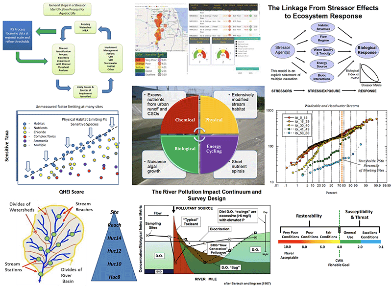
The Northeastern Illinois Integrated Prioritization System (IPS) provides the framework within which high resolution monitoring data and assessment results are organized, analyzed, and merged to better support Clean Water Act (CWA) management programs in meeting their goals and objectives and guiding a wide array of water quality related decision-making. It was developed to better inform the actions of watershed groups in Northeastern Illinois by identifying patterns and thresholds of stressors that affect aquatic life condition based on comprehensive analyses of a regional database comprised of high resolution biological, habitat, chemical/physical, and land use parameters and indicators. The data was generated by the systematic watershed monitoring conducted by the DuPage River Salt Creek Workgroup (DRSCW) since 2006, the Lower DuPage River Watershed Coalition (LDRWC) since 2012, the Des Plaines River Watershed Workgroup (DRWW) since 2016, and the North Branch Chicago River Watershed Workgroup (NBWW) since 2018 that has been focused on determining the status of Illinois aquatic life designated uses and determining the causes (agents) and sources (origins) of impairments and threats. Suitable data from Illinois EPA and Illinois DNR was also used to supplement these more spatially intensive datasets. The limits of application include small headwater streams, wadeable streams, and small rivers up to 350 mi.2 in drainage area. The thresholds and analyses are not suitable for application outside of these stream and river sizes.
Federal Water Pollution Control Act, Public Law 92-500 (33 U.S.C. 1251 et seq.) as amended via PL 107-303, Nov. 2002.
The IPS houses analyses of complex environmental data about biological indicators and the effect that chemical, physical, and land use variables have on the measured and potential condition of the biota and water quality at the site, stream or river reach, and watershed (HUC12) scales. Regionally scoped data of sufficient resolution is required to determine the extent and severity of stream and river impairments and for developing stressor thresholds for supporting local scale restoration and protection. The IPS is intended to be used where systematic monitoring and assessment has been conducted at the local watershed scale of resolution (e.g., HUC12) such that paired biological, chemical, physical, and land use data is generated to evaluate current conditions. In places where existing data is spatially insufficient, a systematic collection of data to fill spatial gaps will need to be undertaken as a first step towards IPS usage. The IPS provides direct insights into the highest priority stressors affecting watershed health in order to identify projects and initiatives with the greatest potential to attain stream use goals. Iterative monitoring then provides the feedback needed to properly assess the impacts of cutting-edge stream restoration projects and water quality initiatives to better formulate future activities.