The Clean Water Act, passed in 1972, is charged with protecting the chemical and physical health and biodiversity of the Nation’s waters, including streams and rivers. While the Act has a lot of power for controlling pollution from industrial pollution and sewage (“point sources”) and in some case polluted runoff, it has much less power for protecting physical habitat in streams and adjacent floodplains. These are the areas that the best science identifies as crucial for protecting the biological diversity of streams and for assimilating nutrients, fine sediments, and dissolved chemicals. As stream habitats are damaged and floodplains are filled and encroached upon, nutrients, fine sediments and other chemicals are exported downstream to large rivers, some lakes and ponds, the Great Lakes, oceans and the Gulf of Mexico. A very recent USGS report (Munn et al. 2018) on nutrients’ impacts on aquatic life in the US showed that in a majority of the watersheds studied, habitat exerted a greater impact on aquatic life than nutrients.
The Clean Water Act directs states to assess their waters to identify whether they meet the goals of the CWA and if not, what pollutants or stressors are responsible for such a failure. Most states have a staff of professionals including biologists, water chemistry specialists, engineers, and other specialized scientists that are charged with these assessments. US EPA also collects data to answer questions about waters at a National scale and to conduct basic and applied research on aquatic ecology, human health and other issues.
A strong professional staff of biologists and water quality scientists must provide a robust core of monitoring data to drive water resource quality monitoring in every state. Given the cost of fixing water quality problems (e.g., estimated 2 billion to deal with sewer overflows in Cincinnati area alone!) it makes economic sense to understand what problems (e.g., pollutants, habitat, etc.) are truly limiting and to spend dollars wisely.
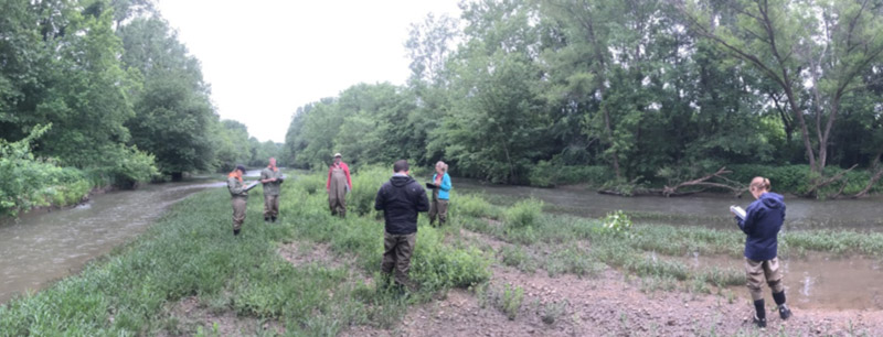
Given that there is a cadre of professional scientists who focus on water quality issues, is there a role for the citizen scientist? There are a number of important reasons why citizen monitoring is essential to making progress on protecting our streams and rivers. Once citizens become aware of the importance of monitoring and its role for protecting the environment, they often become advocates for professional monitoring efforts. Most states have a rotating watershed approach to monitoring, but even the best programs (and Ohio has been one of these) only have resources to reach a watershed every 510 years when fully funded.
Impacts that occur between these periods could be missed and result in changes difficult to alter (e.g., habitat alteration, floodplain development) after the fact. When monitoring funding is reduced States often reduce efforts to sample smaller headwater streams, and focus on larger waters where regulatory issues such as discharge permit issues are more common. Given that many of the most limiting stressors to aquatic life occur in headwater streams this data gap may be shortsighted.
Another Inconvenient Truth
While it would be “easy” to ignore the importance of small streams to downstream water quality, it is an “inconvenient truth” that we ignore these waters at our own peril. Research identifies headwater streams, which make up 80-90% of all stream miles in a State, as the best location to keep nutrients and fine sediments from reaching downstream areas. These are exactly the areas that are often under-monitored (and consequently underprotected) due to lack of resources. The pathways that nutrients, sediments and other pollutants take are most often controlled by the physical features of stream habitats and riparian and floodprone areas that border streams. Our research in Ohio suggests that these waters are most often unassessed and that protection, particularly of floodprone areas, is largely relegated to local efforts for protection. Where local interest in these resources is lacking there is a high risk of them being lost or degraded. Thus, perhaps the most important mission for citizen monitoring is maintaining the interest in the protection of local streams and floodplains.
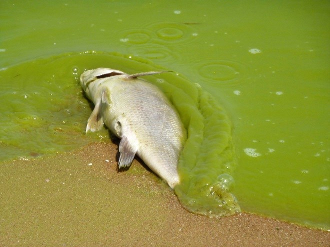
Nutrients: We are primarily talking about nitrogen and phosphorus. All plants and animals need nutrients to survive and grow. Too much fertilizer or the lack of natural areas along a stream to capture and process nutrients results in excess amounts that run into streams during rain events. This can cause algae to “bloom” some of which can produce “toxins” but also reduces oxygen when they respire or when they sink to the bottom and die.
Small streams may seem insignificant, but it is the cumulative effects of not protecting these streams and their floodplains that has resulted in the loss of species and many of the nutrient and toxic algae problems evident in downstream waters such as Lake Erie, Grand Lake St. Marys and the Gulf of Mexico. Each of these waters has severe nutrient and related algal problems that originate on the land’s surface and reach these waters through flood plains and headwater streams. There has been success in reducing phosphorus from detergents and many impacts from sewage treatment. It is now the application of the fertilizers in both agricultural and urban/suburban settings that is a prime initiator of these problems. Here we discuss the role of citizen monitoring in tackling these impacts.
Types of Citizen Monitoring
There are numerous citizen monitoring programs, some of which focus on biology, usually macroinvertebrates or water chemistry, often oxygen, nutrient, and bacteria. Both biological and chemical monitoring are important and useful, but it is usually the biological diversity aspects that first draw people to streams and sustain their interest. At the same time, accurate identification of macroinvertebrates and fish can be difficult and that is one reason why different levels of monitoring have been defined. In Ohio different types of data are specified under a “Credible Data Law.” The Credible Data law recognizes three levels of data, the highest of which (level 3) is done largely by professional ecologists, level 2 which is generally done by trained volunteers or staff who often collect such data in a systematic way (e.g., watershed studies), and level 1 data which is collected by interested citizens with a primary goal to educate them about the diversity and beauty of the aquatic ecosystems so they can help protect and become an advocate for the resource.
“No one will protect what they don't care about; and no one will care about what they have never experienced.” - David Attenborough
Biodiversity
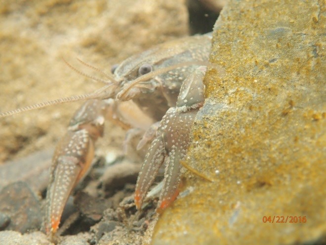
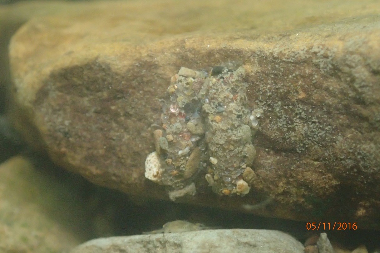
It is the high biodiversity in streams that often attracts the public interest while at the same time making their identification so challenging. It is estimated by Voshell (2009) that: “In North America, there are more than 8,600 species of insects associated with freshwater environments during some part of their lives.” In Ohio, the professional biologists at Ohio EPA and MBI have identified over 1300 different aquatic invertebrate taxa types (e.g., many to genus and species). Condensed to family level there are still over 140 different families of aquatic invertebrates.
The two most widely used volunteer monitoring methods for macroinvertebrates in Ohio are the Stream Quality Monitoring Assessment (SQM) used by Ohio’s Scenic River Program and the Save our Stream (SOS) program developed by the Izaak Walton League of America. The SOS program is similar to the SQM and based on family and order-level identification. These are both what are referred to as Level 1 methods, and are widely used by citizen monitors. For those who can pass the next, or Level 2 (family level) taxonomy test, the data can be used for trend assessment analyses. Periods between Level 3 Ohio EPA intensive surveys can be as long as 10-15 years. Level 2 data and trends in this period can be used to alert EPA to emerging threats that might need immediate attention. Refer to the invertebrate collection methods for each Credible Data level in Ohio with examples in Table 1.
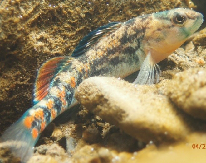
Fish
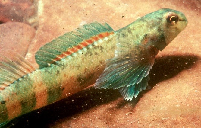
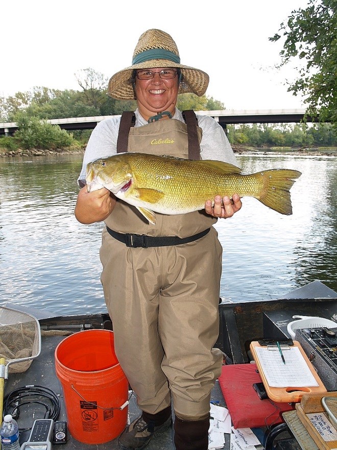
Over 160 species of fish have been identified in Ohio with some wellknown (e.g., walleye, smallmouth, spotted and largemouth bass) and others more obscure and more difficult to identify (e.g., darters, minnows, madtom catfish), but still essential to the ecology of our streams and rivers. Currently in Ohio there is only a Level 3 method for fish assemblage data, and this requires extensive training and education. MBI is considering developing a Level II method that could use seining, underwater photography or fish viewers, and would focus on finding the most sensitive species on fast riffle/run areas of streams. Identification could be verified using a photo voucher. The two to three most sensitive species would be used to query Ohio’s extensive Level 3 data to generate a range of likely biological conditions based on the species present.
Physical Habitat
The cumulative effects of habitat loss have been shown to be significant in Ohio streams. Given that 90% of stream miles in the state are small headwaters, the loss of ecological function in these streams determines the condition of downstream waters all the way to Lake Erie or the Gulf of Mexico. Physical habitat data may be some of the most important information that citizen monitors can collect in small streams in Ohio. Ohio uses the Qualitative Habitat Evaluation Index (QHEI) to rate the physical habitat quality of our streams. Level 3 practitioners can collect QHEI data that can be used in regulatory settings and to set restoration and protection goals (see Sidebar) for streams. Level 2 QHEI data collected by watershed practitioners can be very useful, and can help to quantify habitat quality in streams not sampled by Ohio EPA, to pinpoint degraded and high-quality waters, and to detect trends.
Aquatic Life “Use Designations”
Not every stream in Ohio has the biodiversity of Big Darby Creek which is an ODNR State Scenic River and considered an “Exceptional Warmwater Habitat” stream and Outstanding State Resource Water by Ohio EPA. Under the Clean Water Act states must set goals for each stream based on its potential to support aquatic life. Ohio has set “tiered” goals with the most sensitive streams called “Exceptional Warmwater Habitat” and streams of more typical diversity called “Warmwater Habitat.” Some streams that have been extensively modified for drainage or flood control and which are maintained in that condition harbor less sensitive aquatic life are called “Modified Warmwater Habitat.” Some very limited streams, for example, those placed in a concrete channel are called “Limited Resource Waters” and harbor very few tolerant aquatic species.
There is a citizen version of the QHEI (cQHEI, Level I data) that requires much less training, but still rates the same types of physical habitat features of streams. A major goal of this effort is to educate the public about the critical role of physical habitat and floodplains and set the basis for protection of these areas as land is developed. It is much easier to protect resources than to later try to restore these areas. In addition to the primary educational focus of this information we think that cQHEI data collected by trained individuals can provide useable information on habitat quality that can then be linked to downstream Level 3 habitat, chemical and biological data collected by professional scientists. Such links can be used to estimate cumulative effects of habitat to help explain a downstream habitat condition and impairment or attainment of Ohio’s biological criteria. Results can be used by local governments and stormwater managers to prioritize habitat and floodplain protection, restoration and enhancement efforts. MBI has developed an Integrated Priority System (IPS) for SW Ohio that integrates monitoring data for use in local management, protection and restoration actions.
Ohio’s Biological Criteria
Ohio was one of the first States to develop and place “numeric biocriteria” in their water quality regulations. Ohio used unimpacted “reference” sites to develop ecological indices (similar in concept to economic indices of the economy or health indices) and these form the primary basis for determining ecological health of our streams and rivers.
| Table 1. Commonly used and recommended methods for assessing macroinvertebrates in Ohio |
| Level 3 (Professional) |
| Ohio EPA Invertebrate Community Index (Ohio EPA 1989) |
| Lowest Practicable Taxonomy (e.g., genus, species) |
| Level 2 (Watershed Practitioners) |
| Macroinvertebrate Aggregated Index for Streams [MAIS] (Smith and Voshell 1997; Johnson 2007) |
| (SE Ohio Only) |
| Family Level Taxonomy |
| L2 Family Level Taxonomy Test |
| Trend Assessment Analyses |
| Level 1 (Citizen Monitors) |
| Ohio Department of Natural Resources |
| Division of Parks and Watercraft |
| Stream Quality Monitoring Assessment (SQM) |
| Order/Family Level Taxonomy |
| Izaak Walton League of America |
| Save Our Streams (SOS) |
| Order/Family Level Taxonomy |
| Table 2. Commonly used and recommended methods for assessing fish in Ohio |
| Level 3 (Professional) |
| Ohio EPA Index of Biotic Integrity [IBI] and Modified Index of well-being [MIwb] (Ohio EPA 1989) |
| Species-Level Taxonomy (e.g., species) |
| Level 2 (Watershed Practitioners) |
| None Presently |
| MBI is considering develop method based on indicator taxa using riffle/run sampling on small streams with seines, UW photograph or fish viewers |
| Level 1 (Citizen Monitors) |
| No Method Exists |
| Table 3. Commonly used and recommended methods for assessing physical habitat in Ohio |
| Level 3 (Professional) |
| Ohio EPA Qualitative Habitat Evaluation Index [QHEI (Ohio EPA 1989, 2006; Rankin 1995) |
| Level 3 – Training and Testing Required |
| Level 2 (Watershed Practitioners) |
| Ohio EPA Qualitative Habitat Evaluation Index [QHEI (Ohio EPA 1989, 2006; Rankin 1995) |
| Level 2 – Training and Testing Required |
| US EPA RBP Habitat Methods (Barbour et al. 1999) |
| No Ohio Training and has not been statistically related to Ohio biology |
| Level 1 (Citizen Monitors) |
| Citizen QHEI |
| Citizen's Qualitative Habitat Evaluation Index |
| Volunteer Monitoring Manual |