MBI Releases New Primary Headwater Data
Analysis of the Probabilities of the Classification of Small Headwater Streams as Primary Headwater Habitat (PHWH) and Warmwater Habitat (WWH) in Southwest Ohio
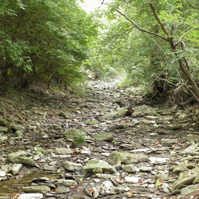
As part of a series of analyses of the attainability of aquatic life uses in small headwater streams in Ohio, MBI analyzed a regional dataset based on recent assessments in southwestern Ohio watersheds. Specifically this analysis focuses on small headwater streams that are at the “boundary” of watershed sizes between Primary Headwater Habitat (PHWH) and Warmwater Habitat (WWH) streams as each is defined and designated by Ohio EPA. Ohio EPA developed the PHWH methodology as a technique for evaluating and classifying the existing uses of small headwater streams that do not harbor fish assemblages capable of meeting the biocriteria for the WWH use designation as codified in the Ohio WQS (Ohio EPA 2002a). While there is no watershed size threshold that can accurately predict whether a stream will be capable of supporting either PHWH or WWH, “rules-of-thumb” have emerged and generally include a 1.0 mi.2 threshold for screening purposes. Some of these thresholds are being considered for routine use in regulatory applications such as 404 Nationwide Permits and without the benefit of vetting with actual site-specific monitoring data. One major problem is that biological and habitat data sufficient to determine the difference between PHWH and WWH (or any of the other Ohio aquatic life use tiers) is generally not collected in streams of this size thus leaving a significant knowledge gap to determine whether or not such rules-of-thumb are accurate or appropriate.
As part of intensive watershed monitoring conducted in the greater Hamilton County area of southwest Ohio, MBI routinely includes sufficient biological and habitat data collection in small headwater streams with some sites <0.5 mi.2 in drainage area. Furthermore, data was collected in a manner that allowed for a determination of whether a stream had the potential to attain one of the WWH aquatic life use tiers or if the existing use is more appropriately PHWH. This was performed at any stream site of <2.5 mi.2 based on the early Ohio EPA studies that resulted in the development of the PWHW classification scheme (Ohio EPA 2002b). Since 2011 a total of 96 stream sites of <0.5-2.5 mi.2 were sampled following this approach in the Mill Creek, Little Miami River, and Great Miami River study areas (Table 1). A fourth study area that includes similarly sized tributaries to the Ohio River mainstem were sampled in 2014, but those results have not yet been analyzed. The determination of the appropriate and attainable use designation was performed by Level 3 Qualified Data Collectors under project study plans approved by Ohio EPA. The techniques of data analysis and assignments of aquatic life use designations are the same as that practiced by Ohio EPA1 . Table 1 summarizes the results of this analysis.
1 Watershed assessment reports are available at: http://www.msdgc.org/initiatives/water_quality/index.html
The results are reported in 0.5 mi.2 increments of drainage area and by each of the three major watershed areas and as a total across all areas. The number of sites in each drainage area panel, the number that were assigned the WWH use designation, and the number that were assigned to the PHWH existing use classification are depicted in Table 1. The PHWH existing use assignments are further stratified as PHWH Class 1, 2, and 3. The attainment status of the WWH designated sites are indicated as full/partial/non-attainment in terms of observed attainment of the attendant numeric biocriteria for fish and macroinvertebrates.
Table 1. Results of the analysis of 96 small headwater stream sites of <0.5-2.5 mi.2 in southwest Ohio for the Primary Headwater Habitat (PHWH) existing use classification or the Warmwater Habitat (WWH) use designation.
Overall, 53 of the 96 sites (55.2%) were designated as having WWH potential either because the biological results indicated attainment of the WWH biocriteria or the habitat assessment indicated WWH potential even though the biological data indicated partial or non-attainment. The remaining 43 sites were classified as PHWH existing use Class 1, 2, or 3. More than one-half (53.5%) of these sites were classified as PHWH 3A which means that aquatic salamanders and sufficient macroinvertebrate taxa were observed. Seventeen (17) sites were classified as PHWH 2 (lacking salamanders) and only 3 sites as PHWH Class I, which is due to ephemeral flows, but which retain sufficient channel characteristics. None of the 96 sites were considered to warrant designation as Limited Resource Waters (LRW), although this use designation applies to some larger and highly modified stream segments in the Mill Creek and Little Miami study areas. At least one formerly designated LRW headwater stream segment was changed to PHWH as a result of the focused watershed assessments. In this case, the LRW designation was based on an upstream extrapolation from a single sampling site located downstream. This example illustrates the importance of having sufficient data collection and spatial resolution in the sampling design. PHWH existing use classifications were more frequent in the smaller drainage area panels and were included in all of the drainage area panels. WWH was assigned in all of the panels including those <0.5 mi.2 and <1.0 mi.2.
These results demonstrate that applying a simple “rule-of-thumb” such as 1.0 mi.2 as the size limitation for the WWH designation would have resulted in the erroneous classification and/or designation of 22 of 47 sites draining <1.0 mi.2 (46.8%). It also illustrates that simply extrapolating uses to apply to the upstream reaches of a stream has the potential for similar error propagation. Sufficient data collection and spatial scale resolution are both needed to avoid making errors in applying policies and permitting in small headwater streams. This means that for streams with permanent water and especially those with flow should require data collection that meets the provisions of the Ohio WQS and Ohio EPA methods. In such cases this will need to include the collection of fish, macroinvertebrates, and salamanders along with the QHEI as the principal habitat assessment (HHEI can be extracted from a QHEI). This promotes sound data as driving the decisions about designated and existing uses in small headwater streams. These results should be applicable beyond southwestern Ohio to similar topographies in the rest of Ohio.
References:
Ohio EPA. 2002a. Field Evaluation Manual for Ohio’s Primary Headwater Habitat Streams. Final Version 1.0. Division of Surface Water, Columbus, OH. 60 pp.
Ohio EPA. 2002b. Ohio EPA Primary Headwater Habitat Initiative Data Compendium, 1999-2000 Habitat, Chemistry, and Stream Morphology Data. Division of Surface Water, Columbus, OH. 23 pp. + appendices.